
 East
Java is one of the Republic of Indonesia's 27 provinces, occupying
an area of some 48,000 km2 just south of the equator. Including
the island of Madura, it accounts for a little more than a third
of Java's total land surface and supports a population of almost
33,000,000 inhabitants. To the east, across a narrow strait,
lies the island of Bali; to the west are the provinces of Central
Java and the Special Region of Yogyakarta. The northern and southern
coasts are markedly different. Silt deposited by the rivers which
empty into the calm and shallow Java Sea has caused the north
coast to grow slowly outwards over the centuries, while in the
south the Sunda Shelf, upon which the Indonesian archipelago
rests, drops steeply into the depths of the Indian Ocean a few
kilometres offshore, creating turbulent currents and dramatic
surf. East
Java is one of the Republic of Indonesia's 27 provinces, occupying
an area of some 48,000 km2 just south of the equator. Including
the island of Madura, it accounts for a little more than a third
of Java's total land surface and supports a population of almost
33,000,000 inhabitants. To the east, across a narrow strait,
lies the island of Bali; to the west are the provinces of Central
Java and the Special Region of Yogyakarta. The northern and southern
coasts are markedly different. Silt deposited by the rivers which
empty into the calm and shallow Java Sea has caused the north
coast to grow slowly outwards over the centuries, while in the
south the Sunda Shelf, upon which the Indonesian archipelago
rests, drops steeply into the depths of the Indian Ocean a few
kilometres offshore, creating turbulent currents and dramatic
surf.
Anyone who opens a physical map of Java will notice immediately
the high, mountainous ridge extending along the entire length
of the centre of the island. Some of the highest and most active
of these volcanic peaks are to be found in East Java, whose flat,
fertile plains are punctuated by no less than six separate ranges,
becoming progressively higher towards the east. These mountains
are among East Java's principal attractions for climbers and
sightseers alike. Some of the more outstanding include the 3,676m
active cone of Mt Semeru, Java's highest peak; the famous sand
sea and steaming crater of Mt Bromo; the sulphureous summit of
Mt Welirang and the strangely beautiful crater lakes of Ijen
and Kelud.
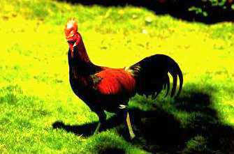
The
Ayam Bekisar, is East Java Mascot
 |
|
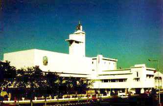
The
office of the Goverment of East Java in Surabaya
 |
|
From the mountains, numerous
rivers flow down through the coastal plains to the sea. Two main waterways,
the Brantas and Bengawan Solo, are lifelines for much of East Java's predominantly
agricultural community. The former rises in the highlands to the northwest
of Malang and follows a circuitous path for 314 km, passing through Blitar,
Tulungagung, Kediri and Mojokerto before dividing into a number of smaller
streams and meeting the sea in the Surabaya region.
The famous Bengawan Solo, longest river in Java, has its source in the
centre of the island to the west of Mt Lawu and stretches 540 km to join
the coast at Gresik. Other important rivers include the Madiun,
Konto, Sampeyan and Grindulu.
Like the landscape, East Java's climate is varied, depending
upon altitude. The plains and lower hill regions are hot and
humid, making conditions ideal for wet rice cultivation (sawah).
Further up in the hills the air becomes quite cool, while in
high mountainous areas at night the temperature can drop to near
zero.
Hill regions are well suited for the cultivation of a large variety
of fruits and vegetables, which thrive in the colder climate.
Principal crops, aside from rice, include corn, tobacco, sugar
cane, coffee, rubber, kapok, cloves, tea, cocoa, peanuts, soybeans
and cotton. In addition, there are extensive plantations of teak
and pine trees. East Java has a marked wet and dry sea son, with
rain occurring between October and April. The wettest months
are December, January and February. |